| Thread Previous • Date Previous • Date Next • Thread Next |
On Tue, Oct 6, 2009 at 2:50 AM, <noreply@xxxxxxxxxxxxx> wrote:
> ------------------------------------------------------------
> revno: 821
> committer: Jan Henrik Overland janhenrik.overland@xxxxxxxxx
> branch nick: trunk
> timestamp: Tue 2009-10-06 02:48:07 +0200
> message:
> (GIS)
> - Bug https://bugs.launchpad.net/dhis2/+bug/440266 fixed.
> - Organisation unit assignment colors and legend fixed.
> modified:
> dhis-2/dhis-api/src/main/java/org/hisp/dhis/mapping/MappingService.java
>
> dhis-2/dhis-services/dhis-service-mapping/src/main/java/org/hisp/dhis/mapping/DefaultMappingService.java
>
> dhis-2/dhis-web/dhis-web-mapping/src/main/java/org/hisp/dhis/mapping/action/GetMapOrganisationUnitRelationByFeatureIdAction.java
>
> dhis-2/dhis-web/dhis-web-mapping/src/main/webapp/dhis-web-mapping/mapping/script/config.js
>
> dhis-2/dhis-web/dhis-web-mapping/src/main/webapp/dhis-web-mapping/mapping/script/index.js
>
> dhis-2/dhis-web/dhis-web-mapping/src/main/webapp/dhis-web-mapping/resources/mapfish/core/GeoStat.js
>
> dhis-2/dhis-web/dhis-web-mapping/src/main/webapp/dhis-web-mapping/resources/mapfish/widgets/geostat/Mapping.js
>
> dhis-2/dhis-web/dhis-web-mapping/src/main/webapp/dhis-web-mapping/resources/mapfish/widgets/geostat/ProportionalSymbol.js
>
>
> --
> lp:dhis2
> https://code.launchpad.net/~dhis2-devs-core/dhis2/trunk
>
> Your team DHIS 2 developers is subscribed to branch lp:dhis2.
> To unsubscribe from this branch go to
> https://code.launchpad.net/~dhis2-devs-core/dhis2/trunk/+edit-subscription
> .
>
> === modified file
> 'dhis-2/dhis-api/src/main/java/org/hisp/dhis/mapping/MappingService.java'
> --- dhis-2/dhis-api/src/main/java/org/hisp/dhis/mapping/MappingService.java
> 2009-09-29 16:17:58 +0000
> +++ dhis-2/dhis-api/src/main/java/org/hisp/dhis/mapping/MappingService.java
> 2009-10-06 00:48:07 +0000
> @@ -257,7 +257,7 @@
> */
> MapOrganisationUnitRelation getMapOrganisationUnitRelation( Map map,
> OrganisationUnit organisationUnit );
>
> - MapOrganisationUnitRelation getMapOrganisationUnitRelationByFeatureId(
> String featureId );
> + MapOrganisationUnitRelation getMapOrganisationUnitRelationByFeatureId(
> String featureId, String mapLayerPath );
>
> /**
> * Returns a Collection of MapOrganisationUnitRelations.
>
> === modified file
> 'dhis-2/dhis-services/dhis-service-mapping/src/main/java/org/hisp/dhis/mapping/DefaultMappingService.java'
> ---
> dhis-2/dhis-services/dhis-service-mapping/src/main/java/org/hisp/dhis/mapping/DefaultMappingService.java
> 2009-09-29 16:17:58 +0000
> +++
> dhis-2/dhis-services/dhis-service-mapping/src/main/java/org/hisp/dhis/mapping/DefaultMappingService.java
> 2009-10-06 00:48:07 +0000
> @@ -408,9 +408,11 @@
> return mappingStore.getMapOrganisationUnitRelation( map,
> organisationUnit );
> }
>
> - public MapOrganisationUnitRelation
> getMapOrganisationUnitRelationByFeatureId( String featureId )
> + public MapOrganisationUnitRelation
> getMapOrganisationUnitRelationByFeatureId( String featureId, String
> mapLayerPath )
> {
> - Collection<MapOrganisationUnitRelation> relations =
> mappingStore.getAllMapOrganisationUnitRelations();
> + Map map = mappingStore.getMapByMapLayerPath( mapLayerPath );
> +
> + Collection<MapOrganisationUnitRelation> relations =
> mappingStore.getMapOrganisationUnitRelationsByMap( map );
>
> for ( MapOrganisationUnitRelation relation : relations )
> {
>
> === modified file
> 'dhis-2/dhis-web/dhis-web-mapping/src/main/java/org/hisp/dhis/mapping/action/GetMapOrganisationUnitRelationByFeatureIdAction.java'
> ---
> dhis-2/dhis-web/dhis-web-mapping/src/main/java/org/hisp/dhis/mapping/action/GetMapOrganisationUnitRelationByFeatureIdAction.java
> 2009-09-22 00:35:09 +0000
> +++
> dhis-2/dhis-web/dhis-web-mapping/src/main/java/org/hisp/dhis/mapping/action/GetMapOrganisationUnitRelationByFeatureIdAction.java
> 2009-10-06 00:48:07 +0000
> @@ -30,6 +30,13 @@
> this.featureId = featureId;
> }
>
> + private String mapLayerPath;
> +
> + public void setMapLayerPath( String mapLayerPath )
> + {
> + this.mapLayerPath = mapLayerPath;
> + }
> +
> //
> -------------------------------------------------------------------------
> // Output
> //
> -------------------------------------------------------------------------
> @@ -48,7 +55,7 @@
> public String execute()
> throws Exception
> {
> - object = mappingService.getMapOrganisationUnitRelationByFeatureId(
> featureId );
> + object = mappingService.getMapOrganisationUnitRelationByFeatureId(
> featureId, mapLayerPath );
>
> return SUCCESS;
> }
>
> === modified file
> 'dhis-2/dhis-web/dhis-web-mapping/src/main/webapp/dhis-web-mapping/mapping/script/config.js'
> ---
> dhis-2/dhis-web/dhis-web-mapping/src/main/webapp/dhis-web-mapping/mapping/script/config.js
> 2009-10-02 13:47:51 +0000
> +++
> dhis-2/dhis-web/dhis-web-mapping/src/main/webapp/dhis-web-mapping/mapping/script/config.js
> 2009-10-06 00:48:07 +0000
> @@ -51,6 +51,9 @@
> AA_MED = 'font-family:myriad pro,frutiger,arial; font-weight:bold;
> font-size:12px; color:#444; letter-spacing:1px;';
> AA_LIGHT = 'font-family:myriad pro,frutiger,arial; font-weight:bold;
> font-size:12px; color:#888; letter-spacing:1px;';
> LABEL = 'padding-bottom:2px; padding-left:3px;';
> +
> + ASSIGNED_ROW_COLOR = '#b1ffa1';
> + UNASSIGNED_ROW_COLOR = '#ffffff';
>
> // Ext.message
>
>
> === modified file
> 'dhis-2/dhis-web/dhis-web-mapping/src/main/webapp/dhis-web-mapping/mapping/script/index.js'
> ---
> dhis-2/dhis-web/dhis-web-mapping/src/main/webapp/dhis-web-mapping/mapping/script/index.js
> 2009-10-05 13:55:43 +0000
> +++
> dhis-2/dhis-web/dhis-web-mapping/src/main/webapp/dhis-web-mapping/mapping/script/index.js
> 2009-10-06 00:48:07 +0000
> @@ -1109,7 +1109,7 @@
> var wmsPreviewWindow = new Ext.Window({
> title: '<font style="' + AA_DARK + '">Preview: ' +
> record.get("title") + '</font>',
> width: screen.width * 0.5,
> - height: screen.height * 0.5,
> + height: screen.height * 0.3,
> layout: 'fit',
> items: [{
> xtype: 'gx_mappanel',
> @@ -1125,7 +1125,7 @@
> title: '<font style="' + AA_DARK + '">Geoserver
> shapefiles</font>',
> closeAction: 'hide',
> width: wmsGrid.width,
> - height: wmsGrid.height,
> + height: screen.height * 0.4,
> items: [wmsGrid],
> bbar: new Ext.StatusBar({
> id: 'wmswindow_sb',
> @@ -1900,7 +1900,7 @@
> title: '<font style="' + AA_DARK + '">Geoserver
> shapefiles</font>',
> closeAction: 'hide',
> width: wmsOverlayGrid.width,
> - height: wmsOverlayGrid.height,
> + height: screen.height * 0.4,
> items: [wmsOverlayGrid],
> bbar: new Ext.StatusBar({
> id: 'wmsoverlaywindow_sb',
> @@ -2593,8 +2593,8 @@
> }
> }
> }
> - });
> -
> + });
> +
> mapping.hide();
> shapefilePanel.hide();
> mapLayerPanel.hide();
> @@ -2906,11 +2906,12 @@
> }
>
> var featureId = feature.attributes[MAPDATA.nameColumn];
> + var mlp = Ext.getCmp('maps_cb').getValue();
>
> Ext.Ajax.request({
> url: path +
> 'getMapOrganisationUnitRelationByFeatureId' + type,
> method: 'POST',
> - params: {featureId:featureId},
> + params: {featureId:featureId, mapLayerPath:mlp},
>
> success: function( responseObject ) {
> var mour = Ext.util.JSON.decode(
> responseObject.responseText ).mapOrganisationUnitRelation[0];
> @@ -2927,7 +2928,7 @@
> params: { mapLayerPath:
> MAPDATA.mapLayerPath, organisationUnitId: organisationUnitId, featureId:
> featureId },
>
> success: function(
> responseObject ) {
> -
> Ext.messageBlack.msg('Assign organisation units', msg_highlight_start +
> organisationUnit + msg_highlight_end + ' (database) assigned to ' +
> msg_highlight_start + featureId + msg_highlight_end + ' (geojson).');
> +
> Ext.messageBlack.msg('Assign organisation units', msg_highlight_start +
> organisationUnit + msg_highlight_end + ' (database) assigned to ' +
> msg_highlight_start + featureId + msg_highlight_end + ' (map).');
>
> Ext.getCmp('grid_gp').getStore().reload();
>
> popup_feature.hide();
>
> loadMapData('assignment');
> @@ -3108,19 +3109,35 @@
>
> var relations =
> Ext.util.JSON.decode(responseText).mapOrganisationUnitRelations;
>
> - var nameColumn = MAPDATA.nameColumn;
> -
> - for (var i = 0; i < features.length; i++) {
> + var nameColumn = MAPDATA.nameColumn;
> +
> + var noCls = 1;
> + var noAssigned = 0;
> +
> + for (var i = 0; i < features.length; i++) {
> features[i].attributes['value'] = 0;
>
> for (var j=0; j < relations.length; j++) {
> if (relations[j].featureId ==
> features[i].attributes[nameColumn]) {
> features[i].attributes['value'] = 1;
> + noAssigned++;
> + if (noCls < 2) {
> + noCls = 2;
> + }
> break;
> }
> }
> }
> -
> +
> + var color = UNASSIGNED_ROW_COLOR;
> +
> + if (noCls > 1) {
> + if (noAssigned == features.length) {
> + noCls = 1;
> + color = ASSIGNED_ROW_COLOR;
> + }
> + }
> +
> var options = {};
>
> /*hidden*/
> @@ -3129,13 +3146,13 @@
> options.indicator = mapping.indicator;
>
> options.method = 1;
> - options.numClasses = 2;
> + options.numClasses = noCls;
>
> var colorA = new mapfish.ColorRgb();
> - colorA.setFromHex('#FFFFFF');
> + colorA.setFromHex(color);
> var colorB = new mapfish.ColorRgb();
> - colorB.setFromHex('#b1ffa1');
> - options.colors = [colorA, colorB];
> + colorB.setFromHex(ASSIGNED_ROW_COLOR);
> + options.colors = [colorA, colorB];
>
> mapping.coreComp.updateOptions(options);
> mapping.coreComp.applyClassification();
>
> === modified file
> 'dhis-2/dhis-web/dhis-web-mapping/src/main/webapp/dhis-web-mapping/resources/mapfish/core/GeoStat.js'
> ---
> dhis-2/dhis-web/dhis-web-mapping/src/main/webapp/dhis-web-mapping/resources/mapfish/core/GeoStat.js
> 2009-09-21 17:41:44 +0000
> +++
> dhis-2/dhis-web/dhis-web-mapping/src/main/webapp/dhis-web-mapping/resources/mapfish/core/GeoStat.js
> 2009-10-06 00:48:07 +0000
> @@ -362,7 +362,15 @@
> * nBins - {Integer} Total number of bins
> */
> defaultLabelGenerator: function(bin, binIndex, nbBins) {
> - return parseFloat(bin.lowerBound).toFixed(1) + ' - ' +
> parseFloat(bin.upperBound).toFixed(1) + ' ( ' + bin.nbVal + '
> )';
> + if (ACTIVEPANEL == 'mapping') {
> + if (bin.upperBound < 1) {
> + return 'Available' + ' ( ' +
> bin.nbVal + ' )';
> + }
> + else {
> + return 'Assigned' + ' ( ' +
> bin.nbVal + ' )';
> + }
> + }
> + // return parseFloat(bin.lowerBound).toFixed(1) + ' - ' +
> parseFloat(bin.upperBound).toFixed(1) + ' ( ' + bin.nbVal + '
> )';
> },
>
> classifyWithBounds: function(bounds) {
>
> === modified file
> 'dhis-2/dhis-web/dhis-web-mapping/src/main/webapp/dhis-web-mapping/resources/mapfish/widgets/geostat/Mapping.js'
> ---
> dhis-2/dhis-web/dhis-web-mapping/src/main/webapp/dhis-web-mapping/resources/mapfish/widgets/geostat/Mapping.js
> 2009-10-05 13:55:43 +0000
> +++
> dhis-2/dhis-web/dhis-web-mapping/src/main/webapp/dhis-web-mapping/resources/mapfish/widgets/geostat/Mapping.js
> 2009-10-06 00:48:07 +0000
> @@ -394,6 +394,7 @@
> */
> classify: function(exception) {
> if (!this.ready) {
> +alert(2);
> Ext.MessageBox.alert('Error', 'Component init not complete');
> return;
> }
>
> === modified file
> 'dhis-2/dhis-web/dhis-web-mapping/src/main/webapp/dhis-web-mapping/resources/mapfish/widgets/geostat/ProportionalSymbol.js'
> ---
> dhis-2/dhis-web/dhis-web-mapping/src/main/webapp/dhis-web-mapping/resources/mapfish/widgets/geostat/ProportionalSymbol.js
> 2009-06-02 17:10:54 +0000
> +++
> dhis-2/dhis-web/dhis-web-mapping/src/main/webapp/dhis-web-mapping/resources/mapfish/widgets/geostat/ProportionalSymbol.js
> 2009-10-06 00:48:07 +0000
> @@ -1,4 +1,4 @@
> - /*
> +/*
> * Copyright (C) 2007-2008 Camptocamp
> *
> * This file is part of MapFish Client
> @@ -130,30 +130,6 @@
> */
> initComponent : function() {
> this.items = [{
> - xtype: 'combo',
> - fieldLabel: 'Indicator',
> - typeAhead: true,
> - name: 'indicator',
> - editable: false,
> - valueField: 'value',
> - displayField: 'text',
> - mode: 'local',
> - emptyText: 'Select indicator',
> - selectOnFocus: true,
> - triggerAction: 'all',
> - store: new Ext.data.SimpleStore({
> - fields: ['value', 'text'],
> - data : this.indicators
> - }),
> - listeners: {
> - // 'select': {
> - // fn: function() {
> - // this.classify(false);
> - // },
> - // scope: this
> - // }
> - }
> - },{
> xtype: 'numberfield',
> fieldLabel:'Min Size',
> name: 'minSize',
> @@ -167,21 +143,14 @@
> width: 30,
> value: 20,
> maxValue: 50
> - },{
> - xtype: 'button',
> - text: 'Submit',
> - handler: function() {
> - this.classify(true);
> - },
> + }];
> +
> +
> + this.buttons = [{
> + text: 'OK',
> + handler: this.classify,
> scope: this
> }];
> -
> -
> -// this.buttons = [{
> -// text: 'OK',
> -// handler: this.classify,
> -// scope: this
> -// }];
>
> mapfish.widgets.geostat.ProportionalSymbol.superclass.initComponent.apply(this);
> },
>
> @@ -207,8 +176,7 @@
> requestFailure: function(request) {
> OpenLayers.Console.error('Ajax request failed');
> },
> -
> -
> +
> /**
> * Method: classify
> * Reads the features to get the different value for
> @@ -223,16 +191,17 @@
> }
> return;
> }
> -
> - this.indicator = 'value';
> - this.indicatorText = 'Indicator';
> -
> - if (!this.indicator) {
> - Ext.MessageBox.alert('Error', 'You must choose an indicator');
> - return;
> - }
> -
> - loadMapData('point');
> + this.indicator = 'MARK1';
> + var minSize = parseInt(this.form.findField('minSize').getValue());
> + var maxSize = parseInt(this.form.findField('maxSize').getValue());
> +alert(minSize + '\n' + maxSize);
> + this.coreComp.updateOptions({
> + 'indicator': this.indicator,
> + 'minSize': minSize,
> + 'maxSize': maxSize
> + });
> + this.coreComp.applyClassification();
> + this.classificationApplied = true;
> },
>
> /**
>
>
> _______________________________________________
> Mailing list: https://launchpad.net/~dhis2-devs
> Post to : dhis2-devs@xxxxxxxxxxxxxxxxxxx
> Unsubscribe : https://launchpad.net/~dhis2-devs
> More help : https://help.launchpad.net/ListHelp
>
>
Attachment:
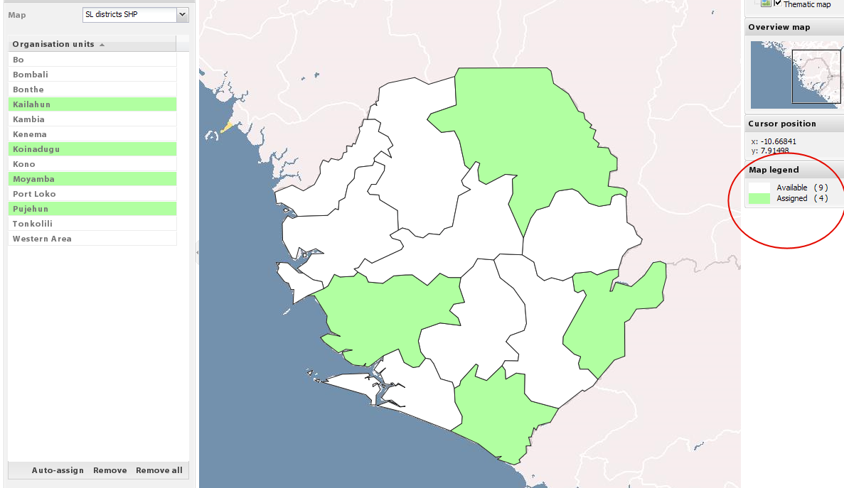
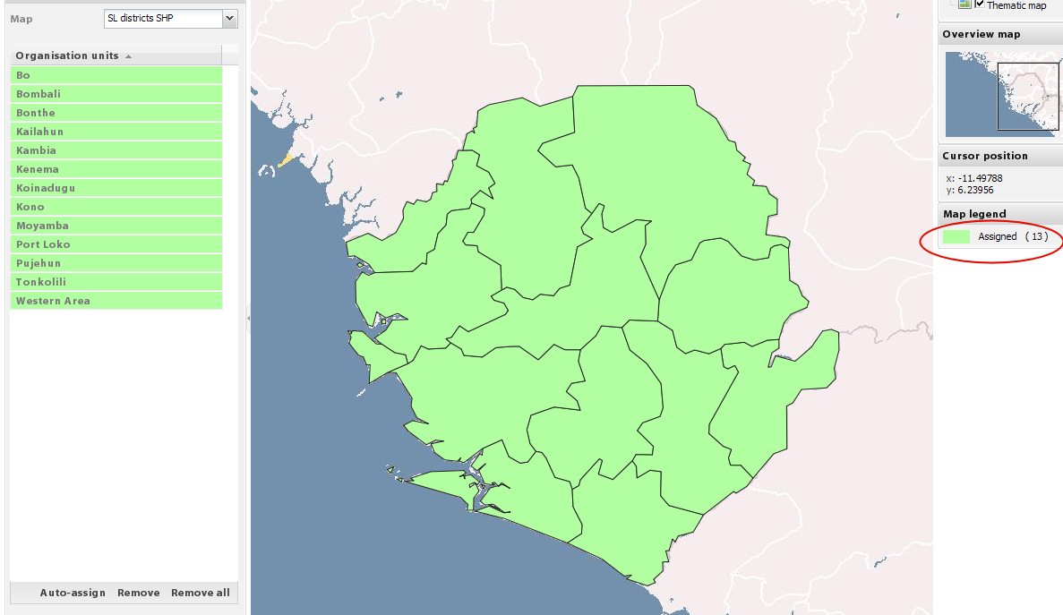
available.png
Description: PNG image
Attachment:
mixed.png
Description: PNG image
Attachment:
assigned.png
Description: PNG image
| Thread Previous • Date Previous • Date Next • Thread Next |